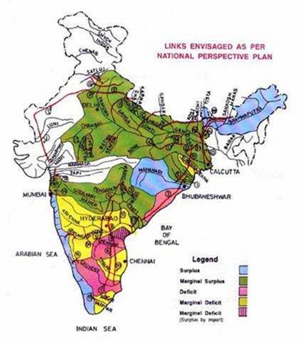
These rivers determine much of the course of action of India, as when they flood or dry up, everything is affected, for better or for worse. Some of these great rivers also have religious and mythological significance, and have been the site of many ancient societies.
All of India’s major rivers come from three main watersheds. The first is the Himalaya and Karakoram Ranges; the second is the Vindhya and Satpura Ranges; the third is the Sahyadri or Western Ghats region. Most rivers go into the Bay of Bengal, but some empty out into the Arabian Sea. There are a few major river networks in India, and then there are dozens of tributaries that flow off from them.
Indian River Systems
The Indus River System is mainly in Pakistan, but some of it is in India. the country of India derived its name from this river, and it is important in the country’s history and heritage. The ancient Indus Valley civilization thrived off of this river and its floodplain, which is one of the world’s oldest known civilizations. They built their settlements around its banks, and created an advanced drainage system for the water.
The river itself originates in Tibet, and is largely fed from the snow of the Himalayas. The Indus River is one of the few rivers in the world that has the sensation of tidal bore, which is when the incoming tidal water forms waves, and the waves travel up the river against the current.
The Brahmaputra River System starts off in Mansarovar Lake (in Tibet), and most of it is outside of India, flowing throughout Tibet and Bangladesh. It is common for this river to flood during monsoon season, which i s June through October, which often results in flash floods, deforestation and soil erosion. The Brahmaputra is one of the longest rivers in Asia.
The Narmada River System flows throughout central India. People associate the regions of North India and South India as dividing through this river. Its name in Sanskrit means “the Giver of Pleasure.” It runs from east to west, and empties into the Arabian Sea. It mostly flows throughout steep banks, so it is difficult to irrigate and navigate.
One famous spot on the Narmada River is Marble Rocks, a gorge in Bhedaghat (close to Jabalpur). These white limestone and basalt rocks are covered with green and black volcanic seams, and are fascinating to look at from a boat. Some of these rock formations reach up to 100 feet, while the river flows between them. The Narmada is also considered a holy river in India, in which one can be purified by washing in the waters.
The Tapti River System flows from east to west in central India. It originates in the Satpura Range, and then flows into the Gulf of Cambay of the Arabian Sea.
The Godavari River System has the second largest stretch of river within India, and its water appears to be brownish. It originates in Trimbakeshwar, which is near Mumbai, and empties into the Bay of Bengal. The river becomes very wide during monsoon season, and then mostly dries up during the winter. It is a sacred river to Hindus, and there are holy pilgrimages to the water, as well asreligious festivals held every 12 years.
The Krishna River System originates in Mahabaleswar and empties into the Bay of Bengal. It is located in central-southern India. Its name means “dark” in Sanskrit. It has one of the most fertile deltas in India, but it can get very dangerous and cause lots of damage during monsoon season, when it reaches over 75 feet in depth.
The Kaveri River System, or the Dakshin Ganga, has religious significance to Hindus. This river was also the water source for many ancient kingdoms in Southern India. It originates in the Western Ghats, and flows into the Bay of Bengal. Its basin is approximately 27,700 square miles. This is an important river, with a developed hydroelectric power system, and use for irrigation andconsumption. One important spot for hydroelectric power is ShivanasamudraFalls. These water falls were the source of the first hydroelectric power station in Asia.
The Mahanadi River System is a large delta that goes through much of India, and drains into the Bay of Bengal. Its source is hard to determine, because it comes from a network of different mountain streams. It has a high content of silt deposit, and it can cause deadly floods. Several hydroelectric power plants are powered by the Mahanadi River System. Its drainage area is an estimated 51,000 square miles.


0 comments:
Post a Comment