 |
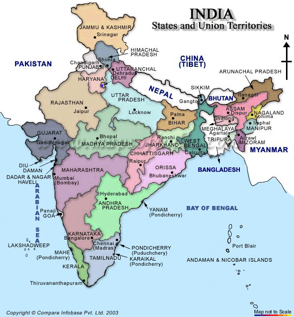
| Indian Map |
India is in Southern Asia, bordering the Arabian Sea and the Bay of Bengal, between Burma and Pakistan known as the subcontinent. In the 19th century, Britain had assumed political control of virtually all Indian lands. Non-violent resistance to British colonialism led by Mohandas GANDHI and Jawaharlal NEHRU brought independence in 1947. The subcontinent was divided into the secular state of India and the smaller Muslim state of Pakistan. A third war between the two countries in 1971 resulted in East Pakistan becoming the separate nation of Bangladesh. With a population of some 1,027 million people, India is now the second country in the world, after China, to cross the one billion mark. The United Nations (UN) estimates that by 2050 India will have overtaken China as the most populous country in the world. Indians make up 16.7 per cent of the world’s population with an annual growth rate of close to two per cent. In 2001, India had 35 cities / urban areas with a population of more than one million people. In total, some 108 million Indians, or 10.5 per cent of the national population, live in the country’s 35 largest cities. Mumbai (Bombay) with a population of more than 16 million is now the world’s fourth-largest urban area followed by Kolkata (Calcutta) in fifth place. Andaman & Nicobar (U.T.), Lakshadweep (U.T.), Andhra Pradesh, Madhya Pradesh, Arunachal Pradesh, Maharashtra, Assam, Manipur, Bihar, Meghalaya, Chandigarh (U.T.), Mizoram, Chhattisgarh, Nagaland, Dadra & Nagar Haveli (U.T.), Orissa, Daman & Diu (U.T.), Pondicherry (U.T.), Delhi (U.T.-NCT), Punjab, Goa, Rajasthan, Gujarat, Sikkim, Haryana, Tamil Nadu, Himachal Pradesh, Tripura, Jammu & Kashmir, Uttar Pradesh, Jharkhand, Uttaranchal, Karnataka, West Bengal, Kerala
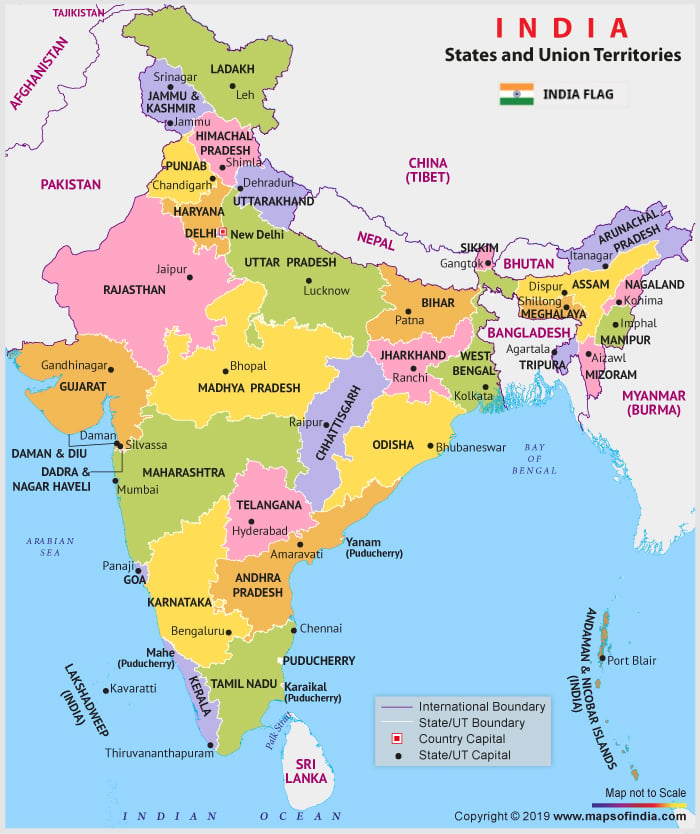 |
| Map of India |
|


0 comments:
Post a Comment